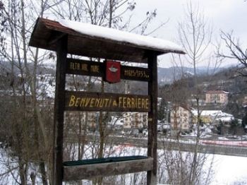
Ferriere
visit to Ferriere in Nure
It is 'the largest capital of the province of Piacenza with an area of 180 sq km. In' High Nure and includes the eastern slope of the Val d'Aveto with the dam and hydroelectric power plant of Woods Ruffinati.
It borders with Liguria to the south, with the towns of Brass, Cerignale and Marsaglia of Cortebrugnatella west and north Farini.
Its highest mountain is the Ox, 1777 meters, on which stands the gondola station.
Attractions for hikers are the landscape, the icy water of the springs and the warm hospitality of the people.
Are part of the landscape alive the old stone houses, the ruins of the castle of Malaspina of millennial Gambaro, the Romanesque church built on Scratch, at Castelcanafurone, the old customs of Maria Luigia to Crociglia on whose ruins was built a hut-hut, water mills, churches and bell towers of the villages.
Striking are the Black Lake, Lake Moo, Lake Bino all of glacial origin.
Its valleys are green and laughing in the summer, snowy winter.
The climate is coastal and mountain to the influence of the Ligurian Sea from which the prevailing winds and visible from the summit of Mount Bue.
The territory of Ferriere, thanks to its variety, is a destination for hiking and climbing trips also challenging and easy.
Upstream of Selva, along the path to the Black Lake and the Ox, you get to Groppo of Ali, gym climbers of the Alpine Club of Piacenza and Codogno, complete with campfire and equipped with a via ferrata.
For lovers of trekking tours, suggested routes are those that lead to Monte Corevolo, 1552 meters, Mount Crociglia, 1578 meters, with a walk of three / four hours through the canal watershed between the Nure and Aveto; the Monte Ragola, 1710 meters, on the road to Canadello-Pertuso, with a path that touches the Monte Menia, 1380 meters, Lake Moo, the summit of San Martino, 1200 meters, Lake Bino, the shelves of grassy Pradello, 1385 meters, and the Great Lawn.
From Mount Ragola wonderful view towards the Ligurian Sea to the south, on the Ceno Valley and the mountains to the east of Parma.
From Passo dello Zovallo the Black Lake, and in half an hour at a good pace, the Monte Bue and Maggiorasca, 1799 meters, overlooking the Ligurian side the valley of Santo Stefano d'Aveto.
Finally a driving route of about 100 kilometers leading to Santo Stefano Aveto through the Passo dello Zovallo and Tomarlo-return Ferriere from Marsaglia, in Trebbia, along the road of Mercatello.
-
Search
-
Categories
- Farmhouses
- Farmhouse in Piacenza and province
- Autumn/Winter Piacentino
- Ferragosto 2105 in Agriturismo
- Restaurants
- Visit Piacentino
- Piacenza Museums
- Castello di Rivalta
- Excursions in the Province of Piacenza
- Recipes Piacentine
- Wines Piacentini
- Typical Products Piacentini
- Events in Piacentino
- Illustrious Piacentini
- Art Piacentina
- library Piacenza
- Photogallery from Piacentino
- Contacts
- Download App
- Mangiare Piacentino
- holiday packages
-
Topics
- Art and Artists Piacentini
- Cooking and traditions
- Illustrious Piacentini
- castle of Rivalta
- Christmas and New Year in Farms
- Valentine in Farms
- Ferragosto in Farms
- Eating in Piacentino
- Farms in Emilia Romagna
- Common Piacentini advocates
- Events in Piacentino
- Emilia Romagna and its Traditions
- Tourism and Piacenza Province
- Routes in Piacenza
- Discipline in Emilia Romagna
- Freetime in Piacentino
- Videos and Movies
- Phoyogallery of Piacentino
- legend Symbols


